Goblin Valley State Park, Arches National Park, Capitol Reef National Park, Canyonlands National Park
•
Info:
Moderate day hike
•
•
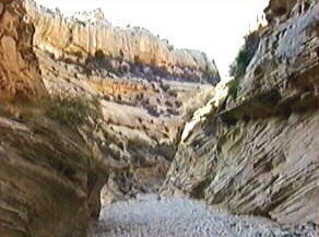
Devils Canyon - Description
Devils Canyon is south of I-70,
Exit 114. The day before we made this hike we checked out the dirt road
going down to Devils Canyon from the view-point above. We found that the
road looked okay. Actually the road was a bit rough and sandy but we had
no major problem and even saw a sedan at the car park. We needed one and
a quarter hour to reach the car park from Green River. We started our hike
early in the morning and covered a lot of ground so quickly that we started
discussing which canyon to visit in the afternoon.
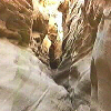
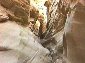
After an hour we reached the narrows. We needed another hour to get down to the
canyon floor because we forgot to take Steve Allen's hike description with us.
The narrows start with a fall about 20´ in height. After some research we found
a zigzag path over the right rim. And yes, after going down there are still 8´
left. You have to slowly scramble down this last steep part of slickrock. If
you do it slow you'll do fine. The way up is a bit easier because there is a
stone that will give you an additional 2´. After some yards there is a side
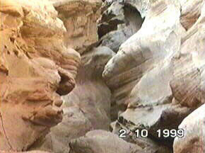
canyon coming in from the left with a log jammed in it.
We couldn't get in because the entrance was much too high (12´ to
15´) maybe next time over the left rim. Steve Allen does it as a digression from
the canyon floor?! Stealing from Fox Mulder:'I want to believe'. If anyone has
done this successfully please email us. The narrows of Devils Canyon are beautiful
but short. After that we hiked some more hours but weren't able to reach the
second narrows. We found 2 really large potholes (swimming-pool-size) on our way
and met a bighorn sheep. We will return in coming years but just for the narrows,
the side canyon and of course the bighorn sheep.
Total round trip was 10mi and took 8 hours. The shorter version would be
4mi round trip and would leave more time for exploring the side canyon.