|  | |
• | Head of Sinbad Pictograph/Locomotive Point - Description | |
|
Leave I-70 at exit 131 (about 30 miles west of Green River) and turn to the south; direction Goblin Valley. If you are lucky, you can get an ATV map of this area at the kiosk (on this junction I-70/Temple Mountain Road). Follow the graded dirt Temple Mountain Road (U24) parallel to the freeway for a while, then to a more southerly direction.
Take the third road on the right (the second should also be possible) and follow this road for around 2.7 mi; at this fork turn off to the right. Take again the right track at the next fork 2 miles later. After 1.5 mi (around 9 miles after leaving the freeway) you will arrive at the very sandy I-70 underpass, passable only by 4WD cars. Conditions may vary; we had to clean it from a bumper and some other car parts.
Roads behind the underpass are very sandy.
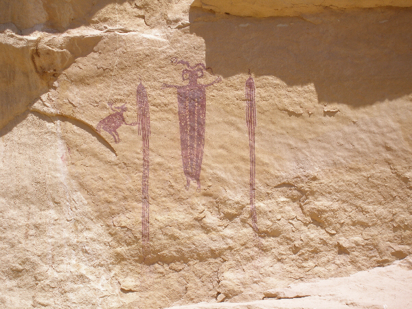
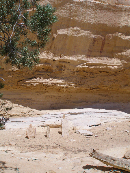
From the underpass take the right track and drive 0.25 mi until you reach a tee, turn right and follow the main road. The 'Head of Sinbad' pictographs are located on the south side of Locomotive Point, a long rock butte which is approximately 1.5 mi from the underpass away. The two Barrier Style pictograph panels are enclosed inside a fence.
|
|
|
|
|
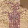
Head of Sinbad Pictograph Locomotive Point 1.
|
|
|
|
|
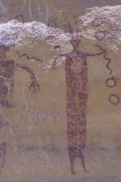
Head of Sinbad Pictograph Locomotive Point 2.
|
|
|
|
|
Present meets past; this place seems to inspire.
|
|
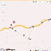
You will find the map 'Head of Sinbad Pictograph Locomotive Point' here.
|
|
| |
• | If you would like to comment on Head of Sinbad Pictograph/Locomotive Point, give a feedback or for example recommend something - here - please.
| |