|  | |
• | Horseshoe Canyon - Barrier Canyon - Description | |
|
Original name of this canyon was Barrier Canyon, derived from the Barrier Creek who had done all the work of creating this beautiful piece of nature. But this name has fallen out of favor, so - now it is called Horseshoe Canyon (Unit of Canyonlands National Park). But there are still some of the best preserved Barrier-Style pictograph panels on the canyon floor. Don't be confused with Horseshoe-Style; this should be something very different.
Leave the State Route 24 a half mile south of Temple Mountain Rd. and turn off in eastern direction on the Lower San Rafael Rd. (BLM road 1010). Drive around 24 miles on the graded dirt road (usually passable by 2WD, but the road may have sandy or rough parts) to the fork with an information kiosk where the road divides in a southern track to Hans Flat Ranger Station (the entry to the Maze district of Canyonlands National Park) and the northern track. Turn left heading north towards Horseshoe Canyon and drive 5 miles to a sign pointing right to the Horseshoe Canyon. Follow this rougher dirt road for about 2 mi to the trailhead.
From the trailhead, featuring a small campsite and restrooms, follow the old jeep road down to the canyon floor with an elevation loss of 750 feet. On the way down don't step into a small circle of rocks, it encloses a dinosaur footprint - another prehistoric canyon dweller. The chance to find the footprint later on the way up (with a felt elevation gain of 1500 feet) will be much higher, probably because you will spend more time on the old road. Carry enough water with you, to be prepared for the time when you climb out of Horseshoe Canyon. The sun has no mercy during the hot summer months.
When you reach the bottom turn right and hike south on the canyon floor. The famous Indian art rock panels are easy to find along the path.
This rock art, the Barrier Canyon Style is attributed to Archaic people.
In todays believe Late Archaic people painted the Barrier Canyon Style between 2500 and 1500 years ago. Speculations dating to as early as 6000 to 8000 years ago.
For road conditions:
Hans Flat Ranger Station phone: 435-259-2652
Canyonlands National Park Service Moab, backcountry information phone: 435-259-4351
|
|
|
|
|
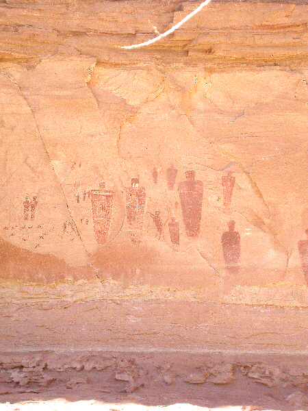
Horseshoe Canyon, Barrier Canyon - Great Gallery.
|
|
|
|
|
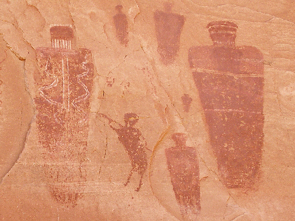
Let's have a party. Kokopelli plays the flute.
|
|
|
|
|
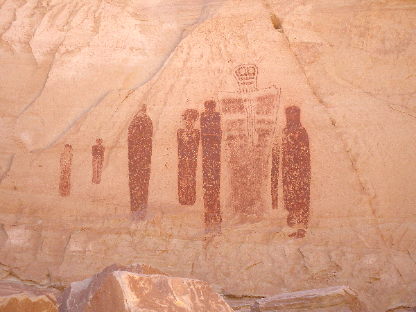
Ghost man group.
|
|
|
|
|
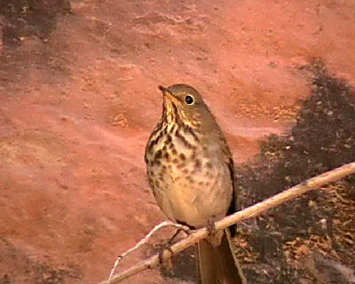
Swainson's Thrush, living there.
|
You will find the map 'Horseshoe Canyon, Barrier Canyon' here.
|
|
| |
• | Further Reading: | |
| | |
• | If you would like to comment on Horseshoe Canyon - Barrier Canyon, give a feedback or for example recommend something - here - please.
| |